Fichier:GeneralMapOfDistancesAndHistoricCapitals.jpg
Taille de cet aperçu : 744 × 599 pixels. Autres résolutions : 298 × 240 pixels | 596 × 480 pixels | 953 × 768 pixels | 1 271 × 1 024 pixels | 2 542 × 2 048 pixels | 3 493 × 2 814 pixels.
Fichier d’origine (3 493 × 2 814 pixels, taille du fichier : 6,14 Mio, type MIME : image/jpeg)
| Ce fichier et sa description proviennent de Wikimedia Commons. | Accéder au fichier sur Commons |
Erreur : l’attribut name des indicateurs d’état de la page ne doit pas être vide.
Description
Conditions d’utilisation
|
Ceci est une reproduction photographique fidèle d'une œuvre d'art originale en deux dimensions. L'œuvre d'art elle-même est dans le domaine public pour la raison suivante :
La position officielle de la Fondation Wikimedia est que « les représentations fidèles des œuvres d'art du domaine public en deux dimensions sont dans le domaine public et les exigences contraires sont une attaque contre le concept même de domaine public ». Pour plus de détails, voir Commons:Quand utiliser le bandeau PD-Art.
Cette reproduction photographique est donc également considérée comme étant élevée dans le domaine public. Merci de noter qu'en fonction des lois locales, la réutilisation de ce contenu peut être interdite ou restreinte dans votre juridiction. Voyez Commons:Reuse of PD-Art photographs. | ||||
Historique du fichier
Cliquer sur une date et heure pour voir le fichier tel qu'il était à ce moment-là.
| Date et heure | Vignette | Dimensions | Utilisateur | Commentaire | |
|---|---|---|---|---|---|
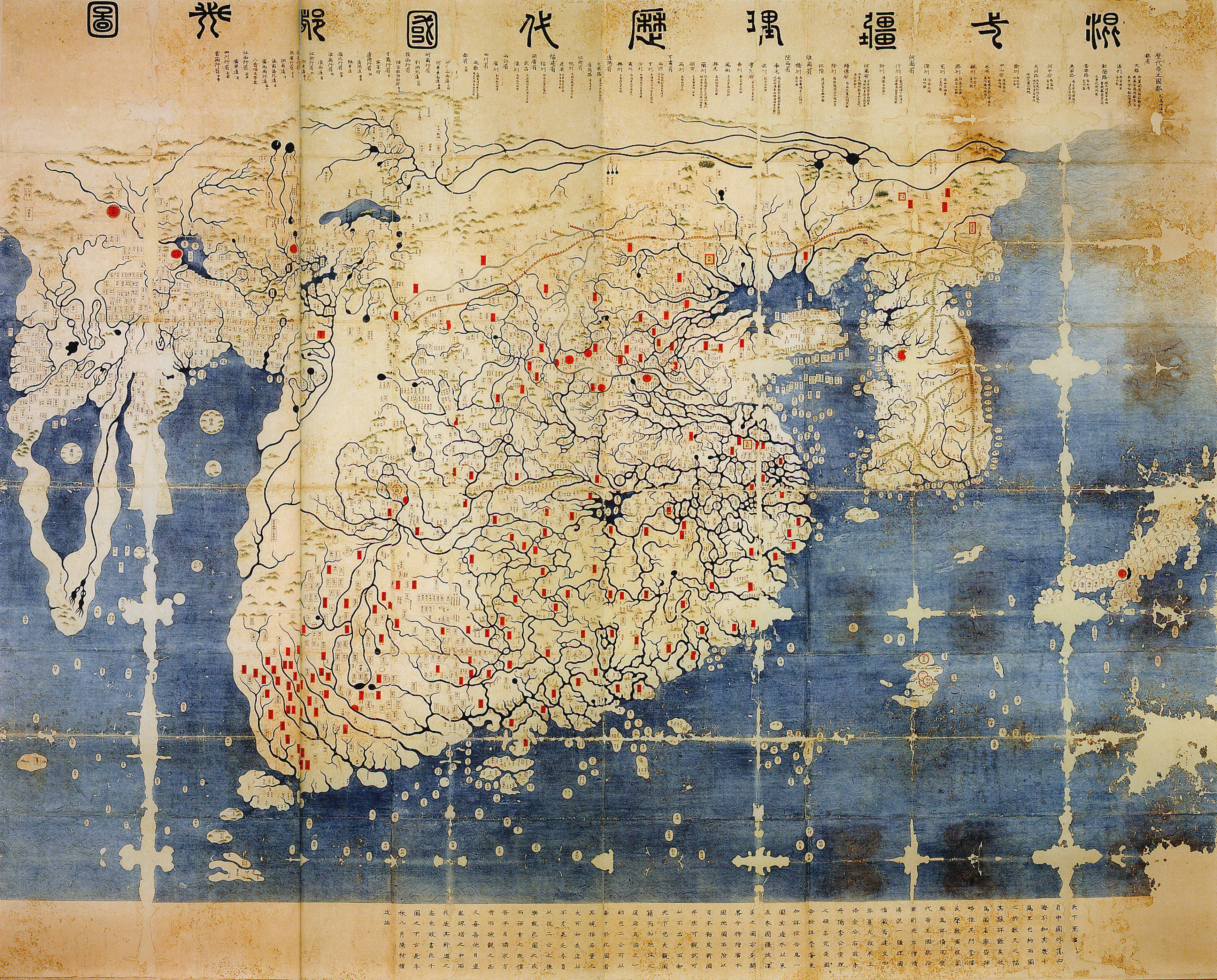
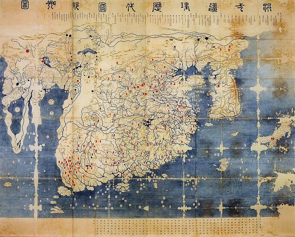
| actuel | 11 juin 2008 à 14:40 | | 3 493 × 2 814 (6,14 Mio) | Yaan | == Summary == {{Information |Description = General map of the distances and the historic capitals (chinese: Hunyi jiangli lidai guodu zhi tu; japanese: Kon'itsu kyoori rekidai kokuto no zu), Korea, roughly 1470. Ink and paint on paper. Height 220 cm, widt |
Utilisation du fichier
La page suivante utilise ce fichier :
Usage global du fichier
Les autres wikis suivants utilisent ce fichier :
- Utilisation sur en.wikipedia.org
- Utilisation sur fr.wikipedia.org
- Utilisation sur ko.wikipedia.org
- Utilisation sur ru.wikipedia.org
- Utilisation sur uk.wikipedia.org
- Utilisation sur www.wikidata.org
- Utilisation sur zh.wikipedia.org